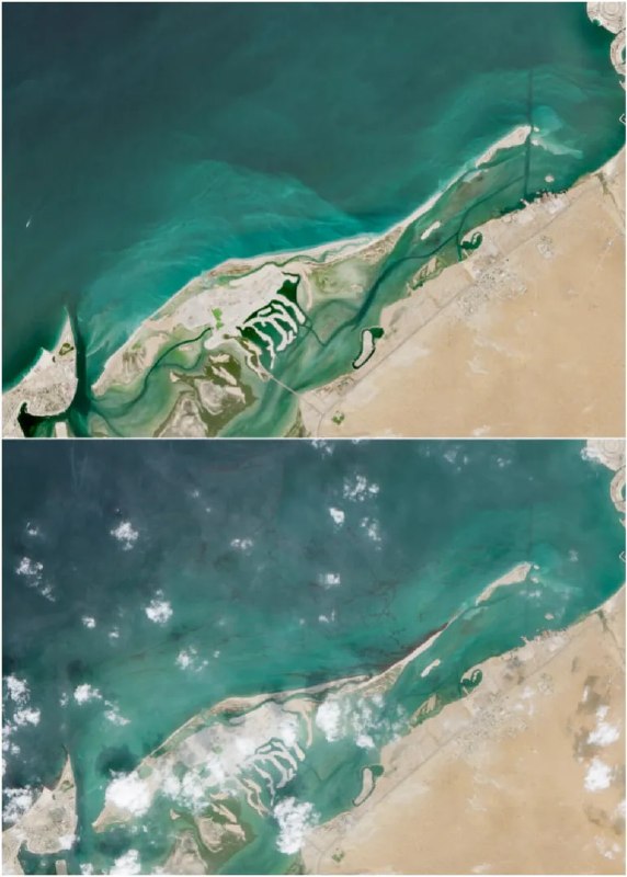
Satellite images reveal expanding oil spill off UAE coast following tanker attack An oil spill off the coast of the United Arab Emirates continues to expand rapidly, forcing local authorities to restrict public access along several northern beaches. High-resolution satellite imagery reveals the slick moving towards the shores of the emirate of Umm al-Quwain. While the UAE Ministry of Climate Change and Environment confirmed on Friday that containment teams are actively working to contain the spill, the official statements omitted the specific root cause of the environmental disaster. Maritime and energy analysts, cited by Reuters, identified the Panamanian-flagged oil tanker Gem No. 2 as the likely source of the slick following an unidentified missile strike last month. The vessel was transiting critical waterways in the Gulf when it sustained heavy structural damage, causing crude oil to spew into the surrounding waters before drifting towards the UAE coastline. The increased attacks targeting commercial shipping and energy infrastructure in the Gulf have heightened warnings from environmental groups about long-term marine pollution, severe damage to corals and the threat posed to regional desalination plants along the Arabian Peninsula.
Satellite images reveal expanding oil spill off UAE coast following tanker attack An oil spill off the coast of the United Arab Emirates continues to expand rapidly, forcing local authorities to restrict public access along several northern beaches. High-resolution satellite imagery reveals the slick moving towards the shores of the emirate of Umm al-Quwain. While the UAE Ministry of Climate Change and Environment confirmed on Friday that containment teams are actively working to contain the spill, the official statements omitted the specific root cause of the environmental disaster. Maritime and energy analysts, cited by Reuters, identified the Panamanian-flagged oil tanker Gem No. 2 as the likely source of the slick following an unidentified missile strike last month. The vessel was transiting critical waterways in the Gulf when it sustained heavy structural damage, causing crude oil to spew into the surrounding waters before drifting towards the UAE coastline. The increased attacks targeting commercial shipping and energy infrastructure in the Gulf have heightened warnings from environmental groups about long-term marine pollution, severe damage to corals and the threat posed to regional desalination plants along the Arabian Peninsula.