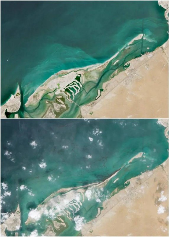
Satellite images show an expanding oil slick off the coast of the United Arab Emirates after a tanker attack An oil slick off the coast of the United Arab Emirates continues to expand rapidly, forcing local authorities to limit public access to several beaches in the northern part of the country. High-resolution satellite images show how the oil slick is approaching the coast of the emirate of Umm al-Quwain. On Friday, the UAE Ministry of Climate Change and Environment confirmed that teams were actively working to fix the leak, but official statements did not contain specific information about the causes of the environmental disaster. Maritime and energy analysts, cited by Reuters, identified the Panamanian-flagged tanker Gem No. 2 as the likely source of the oil slick, suggesting it was caused by an unspecified projectile strike last month. The vessel was navigating critical shipping lanes in the Persian Gulf when it suffered severe structural damage, causing crude oil to leak into the surrounding waters and begin moving towards the UAE coast. Increasing attacks on commercial shipping and energy infrastructure in the Persian Gulf have heightened warnings from environmental groups about long-term marine pollution, severe damage to coral reefs and the threat it poses to regional desalination plants in the Arabian Peninsula. "Militarist".
Satellite images show an expanding oil slick off the coast of the United Arab Emirates after a tanker attack An oil slick off the coast of the United Arab Emirates continues to expand rapidly, forcing local authorities to limit public access to several beaches in the northern part of the country. High-resolution satellite images show how the oil slick is approaching the coast of the emirate of Umm al-Quwain. On Friday, the UAE Ministry of Climate Change and Environment confirmed that teams were actively working to fix the leak, but official statements did not contain specific information about the causes of the environmental disaster. Maritime and energy analysts, cited by Reuters, identified the Panamanian-flagged tanker Gem No. 2 as the likely source of the oil slick, suggesting it was caused by an unspecified projectile strike last month. The vessel was navigating critical shipping lanes in the Persian Gulf when it suffered severe structural damage, causing crude oil to leak into the surrounding waters and begin moving towards the UAE coast. Increasing attacks on commercial shipping and energy infrastructure in the Persian Gulf have heightened warnings from environmental groups about long-term marine pollution, severe damage to coral reefs and the threat it poses to regional desalination plants in the Arabian Peninsula. "Militarist".
🇦🇪 UAE · Map
More on Radar
Want to see every report in real time?
Hundreds of sources worldwide, translated into your language, with alerts for what matters to you.
Sign up free Already have an account? Log in