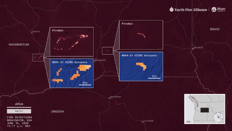
Earth Fire Alliance and Moon Space are planning a covert and verification campaign for The FireSat Earth Fire Alliance (EFA), and Moon Space is planning a covert and verification campaign for the FireSat satellite constellation, designed to detect and track wildfires. The first three satellites, launched in July 2026, are in the comprehensive and first handover phase. By 2030, the group will expand to more than 50 vehicles. The aim of the campaign is to provide scientifically validated data for fire management, modeling and global research. Calibration converts the brightness temperature to the surface temperature and includes three stages: pre-launch laboratory tests, trajectory adjustment for ground targets (buoys, torches, salt) and cross-calibration with data from MODIS, VIIRS and SLSTR (Sentinel-3). Validation will determine the accuracy of the data and will be performed at three levels: ground-based measurements under controlled burns, aerial surveys from drones and aircraft, and comparisons with MODIS and 7RS satellite products. "Hotspots" (probability of disintegration, false positives, warning speed), one meter and spread of fire, radiant power, geographical location, influence of terrain, vegetation, smoke and atmosphere are examined. The first test sites are in Alaska and the southeastern United States. In Alaska, FireSat flies 15-20 times a day, allowing you to follow the full cycle of a controlled burn. About 5,000 dunams (more than 2,000 hectares) of wildfires and 1.2–1.4 million acres of controlled burning occur in Georgia each year, making the area suitable for long-term testing. In August 2026, EFA brought together nearly 30 participants from federal agencies, research organizations and fire services to develop the global detection and verification standards, led by the US Department of Defense, the US Forest Service and FireWERX.
Earth Fire Alliance and Moon Space are planning a covert and verification campaign for The FireSat Earth Fire Alliance (EFA), and Moon Space is planning a covert and verification campaign for the FireSat satellite constellation, designed to detect and track wildfires. The first three satellites, launched in July 2026, are in the comprehensive and first handover phase. By 2030, the group will expand to more than 50 vehicles. The aim of the campaign is to provide scientifically validated data for fire management, modeling and global research. Calibration converts the brightness temperature to the surface temperature and includes three stages: pre-launch laboratory tests, trajectory adjustment for ground targets (buoys, torches, salt) and cross-calibration with data from MODIS, VIIRS and SLSTR (Sentinel-3). Validation will determine the accuracy of the data and will be performed at three levels: ground-based measurements under controlled burns, aerial surveys from drones and aircraft, and comparisons with MODIS and 7RS satellite products. "Hotspots" (probability of disintegration, false positives, warning speed), one meter and spread of fire, radiant power, geographical location, influence of terrain, vegetation, smoke and atmosphere are examined. The first test sites are in Alaska and the southeastern United States. In Alaska, FireSat flies 15-20 times a day, allowing you to follow the full cycle of a controlled burn. About 5,000 dunams (more than 2,000 hectares) of wildfires and 1.2–1.4 million acres of controlled burning occur in Georgia each year, making the area suitable for long-term testing. In August 2026, EFA brought together nearly 30 participants from federal agencies, research organizations and fire services to develop the global detection and verification standards, led by the US Department of Defense, the US Forest Service and FireWERX.
🇺🇸 USA · אלסקה · Map
More on Radar
Want to see every report in real time?
Hundreds of sources worldwide, translated into your language, with alerts for what matters to you.
Sign up free Already have an account? Log in