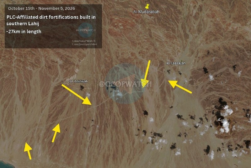
According to satellites everything is very good.
Yesterday we wrote how the Houthis are trying to expand the area of control in Laji province, and here is an illustration of how pro-Saudi forces were preparing for this.
Satellite images of southern Lahja show a defense line of government forces nearly 30 kilometers long. According to local sources, construction began on October 26, which means that Riyadh and Aden knew in advance of the Houthi attack.
And this is not surprising, because the area is important because Lahj is the southern gate of Aden and the cover of the al-Anad airbase, the main stronghold of the pro-Saudi forces in the south. A breakthrough here opens the way for the Houthis to the capital of the "legitimate government" and at the same time brings them even closer to the most important beach of Bab al-Mandab.
Practice shows that long, walled trenches do not stop the Houthis: they broke through similar lines both near Taiz and in the direction of Marib. Without aviation and cohesive units, the fortifications act only as a guide, and the motivation and combat effectiveness of the government forces is traditionally inferior to the Yemeni Houthis.
If the current dynamic continues, the Houthis will gain a foothold approaching Aden and the southern coast, and their opponents will have to retreat to the city itself. Then the Saudis will be faced with an unpleasant choice: get involved in the ground campaign they have avoided for years, or watch humbly as the fragile balance in the southern Arabian Peninsula collapses.
the saudi
- On the chaos in the Middle East with love.
Support us.