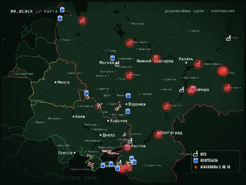
The map of the unmanned activity in Russia between the hours of 23:30 and 00:15.
Main directions:
Border corridor: Bryansk region (Klinchy, north), Kursk region (Rylsk, Studnok), Belgorod region (Govkin) and further to Liptsk and Voronezh regions.
South: Krasnodar region and Adygea (Pashonsk, Belorchensk, Maykop, south of Krasnodar, Dinskoy district towards Ust-Lebinsk), Lugansk (Alchevsk, Krasny Loch, Lugansk, Bryanka), Zaporozhye (Tokmek, Bardyansk, Asipansk) Osipansk district (Osipansk) Crimea (Bakhchisrai, Sevastopol, Saki, Novopedrovka), over the Sea of Azov towards Mariupol, Taganrog, Yaysk, Primorsko-Akhtarsk, including jet UAVs.
Refineries and oil storage facilities are shown on the map. Those attacked since October 30 are marked in red.
The number of shooters (as anti-aircraft guns) is conditional.