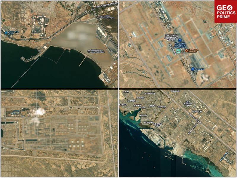
Apple Maps blurs oil sites and airports in Saudi Arabia while Iran's nuclear facilities remain visible.
A foreign news channel reveals a striking gap in commercial satellite mapping: the Saudi energy infrastructure and major airports. Including the King Khaled International Airport in Riyadh. Blurred in dark maps, while Iran's nuclear facilities remain fully exposed.
According to the report, the obfuscation is a defensive measure taken by Riyadh to hide its critical oil infrastructure and airports from the Houthis' ongoing drone and missile attacks.
However, the situation is much more complex when it comes to Iran. Its forces do not rely on commercial applications to track their opponents.
Iran does not need Apple Maps to gather intelligence on US military assets in the region.
Iran has developed and deployed its own military spy satellites, which provide it with high-resolution orbital imagery independently.
This ability allows Iran to bypass any restrictions on commercial maps or American attempts to obscure its bases, ships and regional deployments.
Blurring civilian maps is only "security theater". The US tries to hide its ally's critical infrastructure from public view, but this does not provide any protection on the battlefield.