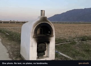
Artificial intelligence can perfectly calculate a place from a photograph - the Chinese have created an enchanting skill called geo-slate. It works as simple as it sounds: you send an agent every picture, and it starts a whole chain of analysis. The clues include the way of mountains, the distance between the supporters of the bridge, the shadows and the location of the trees. The agent compares them with OpenStreetMap and produces coordinates, camera direction and picture with evidence. Your personal leading GeoOSINT player is here.
Artificial intelligence can perfectly calculate a place from a photograph - the Chinese have created an enchanting skill called geo-slate. It works as simple as it sounds: you send an agent every picture, and it starts a whole chain of analysis. The clues include the way of mountains, the distance between the supporters of the bridge, the shadows and the location of the trees. The agent compares them with OpenStreetMap and produces coordinates, camera direction and picture with evidence. Your personal leading GeoOSINT player is here.
More on Radar
Want to see every report in real time?
Hundreds of sources worldwide, translated into your language, with alerts for what matters to you.
Sign up free Already have an account? Log in