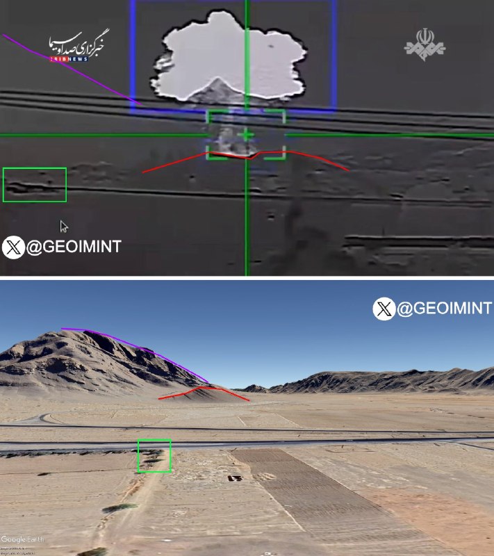
️. Geolocation of photographs recently released by Iranian state media showing EO/IR footage of a US F-15E downing in April 2026 over Iran.
C [estimated POV]: 32.403661, 51.656963.
C [crash site]: 32.381296, 51.671995.
🇮🇷 Iran · Map
️. Geolocation of photographs recently released by Iranian state media showing EO/IR footage of a US F-15E downing in April 2026 over Iran.
C [estimated POV]: 32.403661, 51.656963.
C [crash site]: 32.381296, 51.671995.
Want to see every report in real time?
Hundreds of sources worldwide, translated into your language, with alerts for what matters to you.
Sign up free Already have an account? Log in