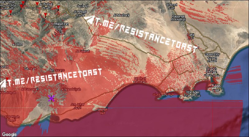
This special map, using mathematical algorithms, accurately depicts the areas where a sniper, ATGM or UAV operator positioned at the peak of the new Jebel Haraz will have a clear line of sight for targeted strikes.
Areas with an unobstructed view from the summit are shown in red. Most of the surrounding desert, sections of crucial supply lines, and even Aden International Airport are now within range of precision weapons.