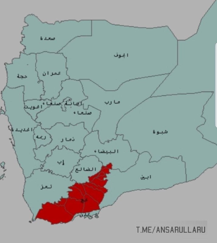
Military Geographical Survey of Lahij District.
The administrative center of Lahij district is the city of Al-Huta, located in Tuban district. The total area of the territory is 15,000 square kilometers, which is larger than the combined area of Qatar and Bahrain.
The district consists of 15 districts (Mudiri):.
The largest in the area is the al-Mudriba district, bordering the Bab al-Mandab strait.
The smallest area is Alhad/Yafa district, which lies on the administrative border with Albayda district.
Operational and military-political situation:
The lowest level of interaction with the instructions of the armed forces and the political leadership from the local population is recorded in three districts: al-Mudribah, Tor al-Baha and al-Muqatira.
The first province to come completely under the control of the Houthi forces was Al-Muqatira province.
The first bridgehead through which the Saudi snipers tried to open a front and advance towards areas under the control of Sana'a was Al-Had/Yafa district (towards Al-Zahir district in Al-Bayda district).
The decisive and quick reaction of the Houthi forces forced the forces of the opposing side to retreat.
Any repeated attempt will result in a counter-attack from Alhad/Yafa district of the Houthis and the transfer of the territory to their full control.
- This was the warning issued by the Sana administration.