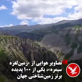
On Wednesday, November 11, the Fars news agency published the images recorded by a UAV from the Simra landslide.
The giant Simre landslide, located on the border of Ilam and Lorstan provinces and on the slopes of Kabirko in the Zagros mountain range, has reached the third list of the top 100 geological heritage sites of the International Union of Geosciences (IUGS).
This selection was announced on Friday, November 6, during this union's International Geological Heritage event in Lulu, Portugal. During this period, two natural monuments from Iran were added to the new list, including the Simra landslide and the Damavand volcanic mountain.
The Simre landslide is one of the largest geological phenomena of the rockfall type in the history of the earth. According to scientific research, the volume of rock material moved in this event is estimated to be about 44 cubic kilometers, making it the largest known non-volcanic landslide on Earth's surface.