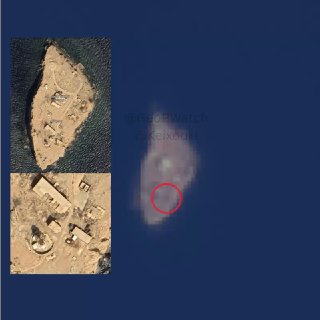
🇮🇷 🇺🇸 🇺🇸 - Satellite imagery analysis conducted by the GeoPWatch team indicates damage to Oman's Didamar Island, located in the Strait of Hormuz. The damage is concentrated in the southern part of the island, suggesting that the Orhaus and radar facilities may be targeted in the reported Iranian strike. The affected area measures about 200 square meters. The satellite images were captured on October 8, suggesting the Iranian attack occurred between October 7 or the early morning hours of October 8. @GeoPWatch.
🇮🇷 🇺🇸 🇺🇸 - Satellite imagery analysis conducted by the GeoPWatch team indicates damage to Oman's Didamar Island, located in the Strait of Hormuz. The damage is concentrated in the southern part of the island, suggesting that the Orhaus and radar facilities may be targeted in the reported Iranian strike. The affected area measures about 200 square meters. The satellite images were captured on October 8, suggesting the Iranian attack occurred between October 7 or the early morning hours of October 8. @GeoPWatch.
🇮🇷 Iran · Map
More on Radar
Want to see every report in real time?
Hundreds of sources worldwide, translated into your language, with alerts for what matters to you.
Sign up free Already have an account? Log in