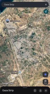
Google Maps has updated its default satellite imagery for Gaza to January-February 2026 imagery, making the scale of the destruction immediately visible to anyone who opens the app.
Tiles 2026 shows crowded residential buildings in Rafah and Khan Yunis reduced to gray rubble fields, the Al-Shifa hospital area that has undergone a major transformation, and massive tent camps in the open space that remains.
UNOSAT's latest count: 201,290 buildings damaged (82% of all buildings), 134,422 destroyed.
The images cover ~235 square kilometers with a resolution of ~13 cm - sharp enough to see individual walls and clusters of tents.
Apple Maps has not made an equivalent update.